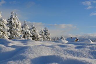
Germany is in for a turbulent weather shift. After strong winds and heavy rain on Thursday and Friday, the first snow of the season could appear this weekend — particularly in the country’s higher elevations, according to the German Weather Service (DWD).
Stormy Thursday: hurricane-like gusts and heavy rain
The change begins overnight into Thursday, as winds strengthen significantly. Storm gusts of 80 to 100 km/h are expected in the southwest, the central highlands, and along the North Sea islands. On exposed mountain peaks, hurricane-force gusts are possible.
The storm will be accompanied by heavy rain and isolated thunderstorms, especially in Rhineland, Hesse, the Black Forest, and the Allgäu. In mountainous areas, up to 40 liters of rain per square meter could fall within a few hours.
Friday: temperature plunge and shifting winds
As the low-pressure system moves east, winds turn from west to northwest, drawing in colder air. Temperatures will drop sharply, reaching only 9 to 14°C in northern and central regions, and just 6°C in the mountains.
By Friday evening, the snow line will fall to around 1,000 to 800 meters, with snowfall possible on the highest peaks of the Black Forest, the Rhön, the Harz, and the Alps.
The wind will remain strong, especially in mountainous regions and along the North Sea, where stormy gusts will persist.
Weekend outlook: snow from 800 meters
Saturday will bring unstable autumn weather across most of the country — a mix of rain, gusty winds, and short sunny breaks.
In the highlands and Alpine regions, the snow line is expected to sink further, and by Saturday night, snow showers may occur above 800 meters, particularly in the Black Forest, Bavarian Forest, and Alps.
In the lowlands, precipitation will fall mostly as rain. Daytime highs will hover between 8 and 13°C, and around 5°C in the mountains.
In Bavaria and Baden-Württemberg, peaks such as the Feldberg and Allgäu Alps could even see a thin snow cover — the first of the season.
Sunday and early next week: wet and chilly
Sunday will remain windy and cold, with temperatures dropping to between 8 and 2°C at night, and near freezing in higher regions. The snow line will fluctuate between 600 and 900 meters.
For the start of next week, DWD expects continued unsettled weather with showers, brisk winds, and cool temperatures barely reaching double digits.
In short: autumn is showing its stormy and early winter side — and mountain regions could get a taste of what’s coming next.


