Germany is experiencing wildly contrasting weather to start the week, with storm-force winds battering the north, persistent rain in the south, and fresh snow blanketing parts of the Alps.
According to the German Weather Service (DWD), the unsettled conditions are being driven by a low-pressure system sweeping in from the northwest — but forecasters say calmer weather is already on the horizon.
Gale-force gusts along the coasts
On Monday morning, stormy conditions continued along both the North Sea and Baltic coasts.
The DWD reported gusts of Force 8 on the Beaufort scale — around 70 km/h — over the German Bight, with occasional Force 9 gusts (up to 80 km/h) along the Baltic Sea.
Even inland, particularly between the Baltic region and Upper Lusatia, winds reached 60 km/h at times before gradually easing through the afternoon.
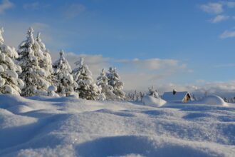
Heavy rain and snow in the Alps
While the wind subsides in most regions, southern Bavaria remains soaked.
Persistent rain is expected to continue along the eastern edge of the Alps, where the DWD warns of significant rainfall totals through Tuesday.
In some foothill areas, 60 to 90 litres of rain per square metre could fall within 36 hours.
By Monday morning alone, up to 35 litres per square metre had already been measured between the Chiemgau and Berchtesgaden Alps.
At higher elevations, snow is falling above about 1 500 metres.
The DWD expects 5 to 10 centimetres of fresh snow, and up to 30 centimetres on the highest peaks.
Rising snow line and ongoing risks
The wintry scene, however, will not last long. By Tuesday night, the snow line is forecast to rise rapidly above 2 000 metres, bringing thawing conditions that may cause slippery roads and minor landslides on steep slopes.
In rain-soaked Alpine valleys, the combination of meltwater and continuing precipitation could raise water levels in smaller rivers and streams.
Gradual improvement ahead
Meteorologists expect the high-pressure influence to strengthen during Tuesday, gradually calming conditions nationwide.
Nevertheless, for areas along the Alpine edge, the DWD maintains local weather warnings until at least Tuesday midday, as ground saturation and thawing snow continue to pose a risk.
Only afterward is a broader improvement in sight — with quieter, drier air spreading from the west.