A powerful storm system is expected to sweep across Germany from Thursday, bringing hurricane-force winds, torrential rain, and thunderstorms, especially across the north and northwest.
Meteorologists from the German Weather Service (DWD) are warning of a potentially explosive storm intensification known as a “bombogenesis” — a rapid drop in air pressure that can transform a regular low-pressure area into a full-blown “bomb cyclone.”
“Traffic disruptions are to be expected — especially along the North Sea coast and in higher regions,” said DWD meteorologist Adrian Leyser.
Storm track across the North Sea — cold front follows
Forecast models show the storm moving from the English Channel into the North Sea, a path that has historically triggered severe weather across Western Europe.
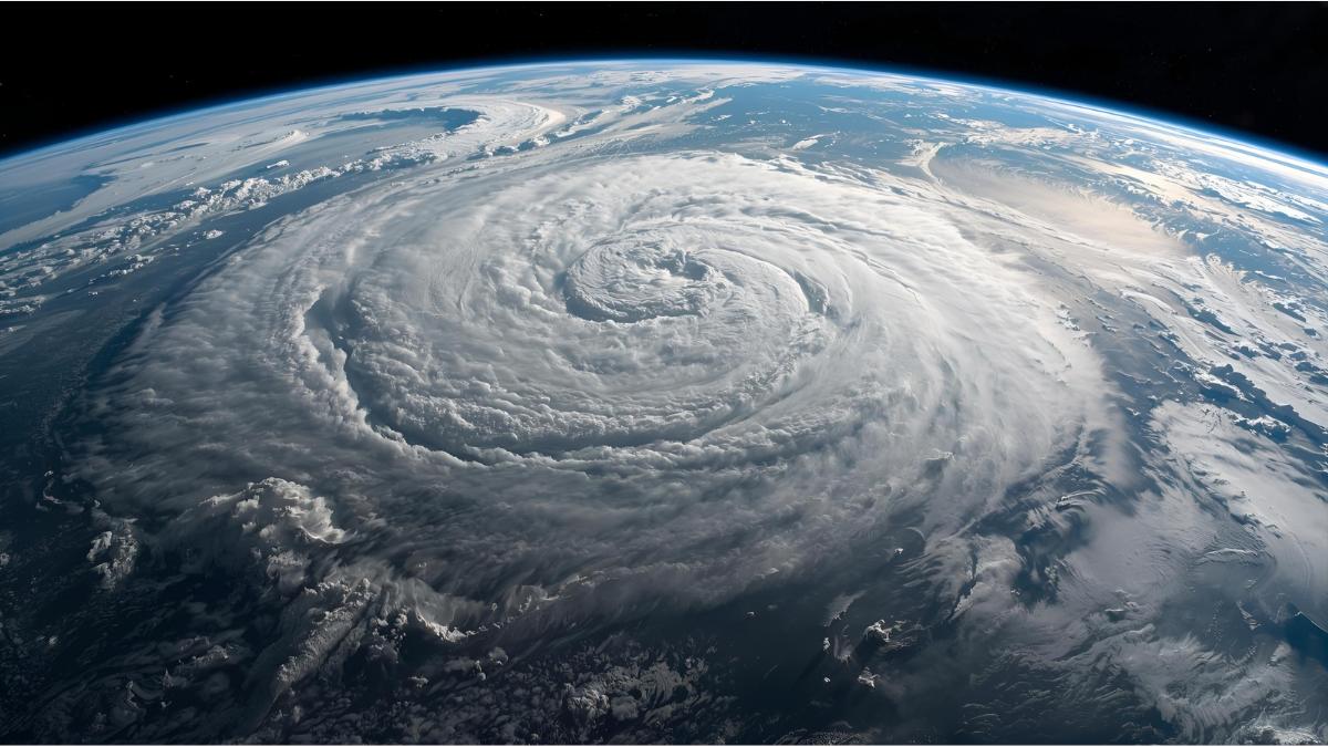
Meteorologists describe it as a large-scale cyclonic system that has developed over the Atlantic and is now intensifying as it approaches Central Europe.
Both the German ICON model and the US GFS model predict a drop of around 24 hectopascals within 24 hours — the exact threshold for “bombogenesis.” The French and European models show a slightly weaker system with a 20 hPa drop, but all agree: strong winds and heavy rain are inevitable.
Weather expert Dr. Karsten Brandt of donnerwetter.de told BILD, “This is an extremely dynamic weather situation where small shifts in the storm’s track can make a huge difference. Whether and where serious damage occurs depends on minimal deviations in the low’s path.”
Gusts up to 160 km/h — storm hits Europe before cooling phase
The German weather model even forecasts wind speeds up to 160 km/h, stretching from the Bay of Biscay over the English Channel and the Netherlands.
Such gusts could cause power outages, fallen trees, and travel chaos in parts of northern and western Europe.
As the storm moves towards Scandinavia on Friday, colder air from the North Sea will flow into Germany, dropping temperatures to between 9 and 14°C. The unsettled, windy, and wet autumn weather is expected to linger through the weekend.
What exactly is “bombogenesis”?
Meteorologists use the term bombogenesis when the air pressure in a low-pressure system drops by at least 24 hectopascals within 24 hours.
This rapid intensification leads to storm-force winds and extreme rainfall, much like a meteorological explosion — hence the nickname “weather bomb.”
While such events usually form over the Atlantic Ocean, this time the system’s path extends into Central Europe, posing a rare and significant autumn weather threat for Germany, the Netherlands, and Denmark.